
The Old Road
Story by Chris Hunt / Photos by Ben Wormald
An Ancient trail used for at least 5,000 years, bridging English Channel and North Sea covering more than five hundred kilometres of secluded rolling chalkland passing through 11 counties. This the story of how we pieced together The Old Chalk Way and our first complete ride through of the 575km route.

Dissecting the densely populated low-lying rolling farmland of Southern England, lies a lone chalk vein. A mixture of well-signposted, well-trodden white gravel chalk paths and overgrown grassy desire lines.This prehistoric highway once provided a dependable trading route from the Dorset coast to the Wash in Norfolk. A continuous diagonal white line.
Largely atop a ridge, the elevated dry terrain historically made for safe transit and sure-footing, capable of supporting livestock and carriages alike while providing its travellers an advantage against potential attacks. Archaeological evidence suggests that this ancient way laid the foundations for the trading of cultures and goods, not only within England but across the channel and the Irish Sea.
An ancient highway steeped in history with Stone Age long barrows, Bronze Age round barrows and Iron Age hill forts all constructed along its path.
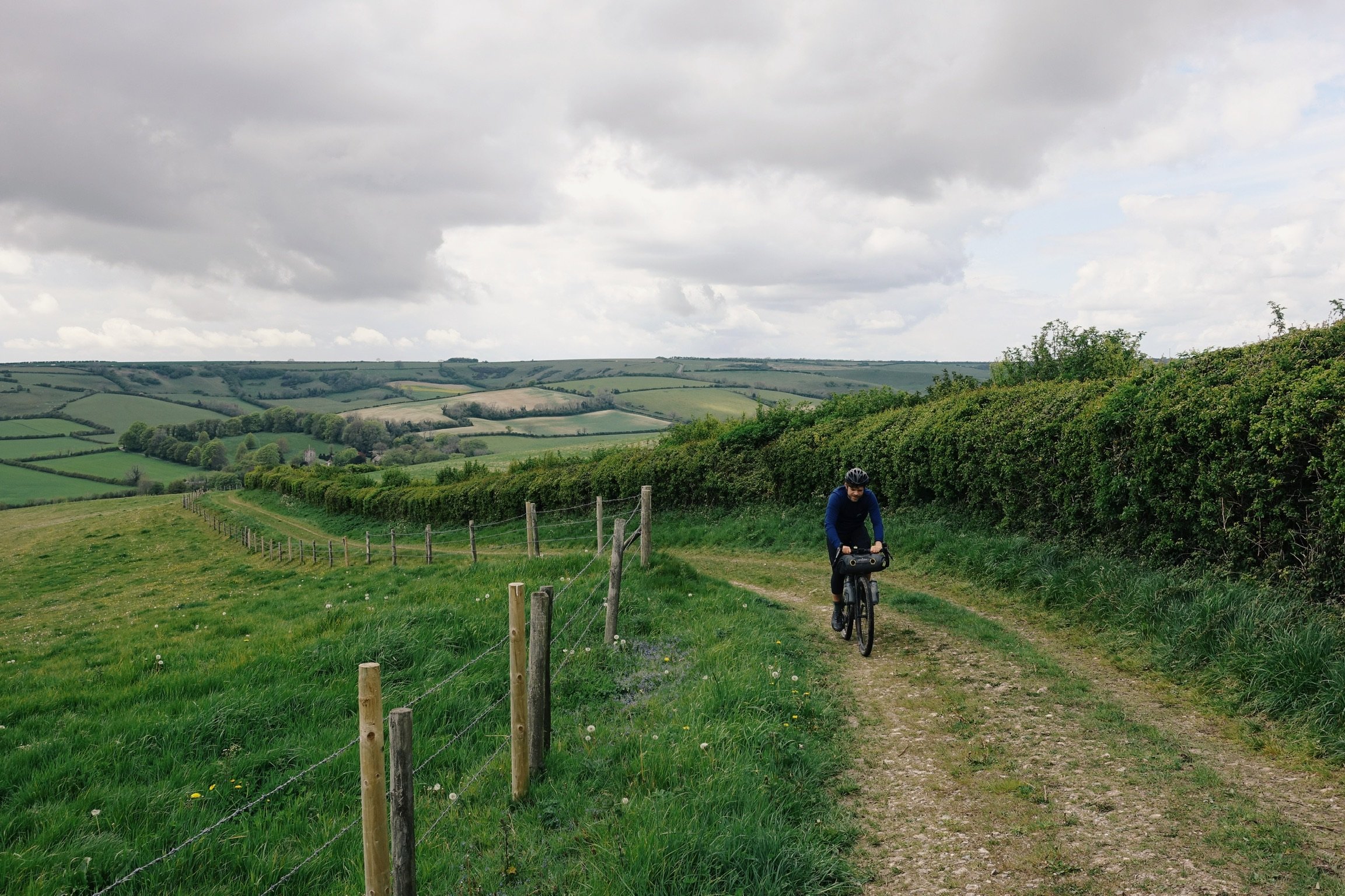
At the end of a long dark winter of lockdown, we set about creating a new bikepacking route following this ancient route. Much of it we knew existed as footpaths, some of it as established bridleways open to biking and horse riding. What we weren’t sure of was how well the route would naturally flow together as one complete entity; how true we should stick to the old ways; and – considering the amount of rainfall during the 24 hours preceding our departure – how our drop bar gravel bikes would cope with the mud and the notoriously slippery when wet chalk.

As the skies grow darker and seafront emptier, on the beach at Lyme Regis we settle on a small row of beach huts in front of which to lay our sleeping bags.
The clattering together of pebbles as the first of the morning’s dog walkers hit the the beach indicates that dawn has arrived too soon. We’re hopeful that those seemingly short hours of sleep were enough to dry the trails. Time to get moving.
The terrain that lines the Jurassic Coast is notoriously steep. Something we’re abruptly reminded of as we take our bikes for their first walks of the journey.
Just 30 kilometres in and I slump my already weary body onto a bench in the middle of the Beaminster village square, commencing an assault on the paper bag of baked pastry obtained on arrival.


We pass the Cerne Giant – perhaps Britain’s best known chalk figure. The origins of the giant have been contested for centuries and while still not 100% certain, recent soil samples suggest it was first dug out in the late Anglo-Saxon period.
While today much of the Greater Ridgeway is sign posted as its separate designated trails, like most pre-historic routes, it would never have been a singular track. Paths would have alternated season to season, transformed and replaced through the successive ages, while various off shoots would provide branches to forts, burial grounds and henges along the way. Similarly, instead of sticking stringently to the routes established by National Trail we’d adapt the route for ourselves. The pioneers of this route some 5,000 years ago didn’t have bikepackers in mind after all. So while riding the full 550km loaded with all our food for the journey was indeed possible, it didn’t sound like much fun. And, unlike the traders, drovers and druids who went before us, we live in a world of convenience, supermarkets and coffee shops.
Detouring to Shaftesbury, we enter into the seemingly mandatory ritual of any bikepacking journey – sprawled across a supermarket carpark floor, we make our way through a small mound of calories to set us up for the day ahead.

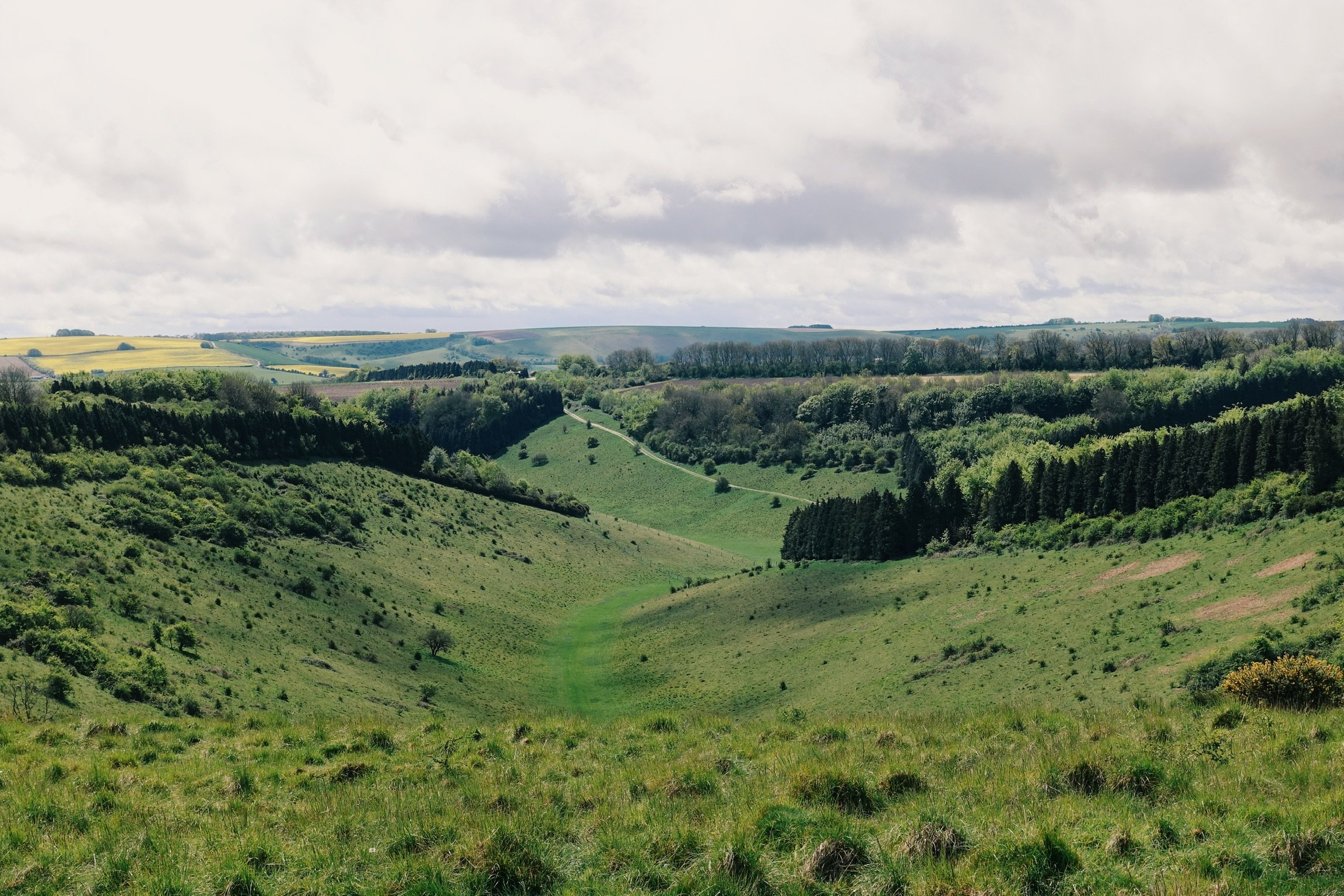
From here, we make our way over Cranbourne Chase, a chalk plateau where the county lines of Dorset, Hampshire and Wiltshire converge. The downland here is scattered with Neolithic and Bronze Age monuments and Iron Age Settlements. The sprawling fields between them repeatedly farmed over the course of six millennia.
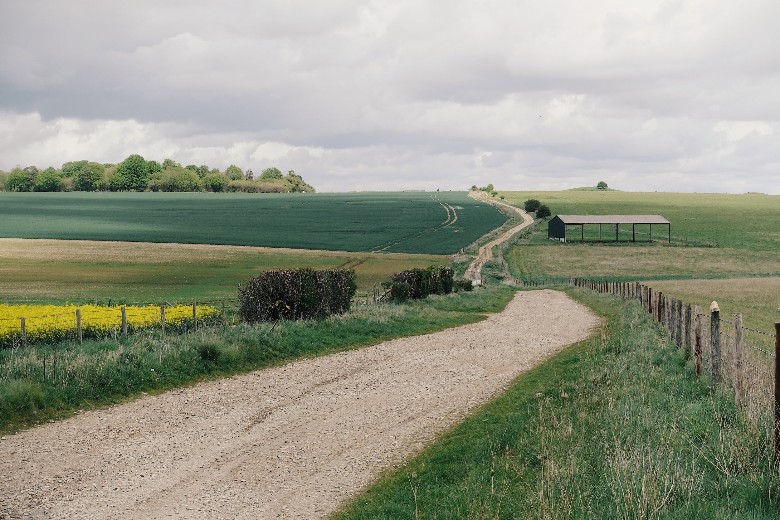
The flat straight gravel tracks traverse fields of rapeseed, barley and cattle and eventually after waiting for a gap in a seemingly endless stream of traffic, we intersect the A303 parallel to Stonehenge.
Rolling north, the clouds close in and the first few drops of rain start threaten. With the red flags of Salisbury Plain lowered, we cut across the training area. 10km of fast rolling, rocky, hard-pack gravel. But here, we’re totally exposed to the wind and the rain. Once we’re committed to the exposed plateau, both of which start right on queue. It takes just moments before we’re wet through and our bikes, our bags and our clothes splatted with the sand and mud from the now saturated track. We grind our way across rocky paths alternating between tail and headwind, avoiding the kind of potholes which threaten the shape of our wheels.


We take a moment’s rest at Avebury henge. Home to the largest megalithic stone circle in the world, this is where our route picks up The Ridgeway.
Thick with mud, dust and dried chalk, a glance at my bike and you’d be forgiven for assuming it had been uncovered as part of some archaeological dig at this ancient site.
Sat with my back against the stones, from deep within my frame pack I dig out the last remaining stragglers from a split pack of chocolate coated raisins.
Joining the first section of The Ridgeway, our tyres roll with a welcome lack of resistance across the firm chalk channels. We snake along the trail, weaving and hopping between confused grassy tracks as they connect, fade and reinvent themselves as we make our way across the ridge.


Enjoying the calm of the moment and the silence around us, we both come naturally to a stop. A brief moment to regroup. Noting the dark sky behind us, a solitary drop of rain splashes off my shoe. Followed by another, and another. In this quiet moment, the rain feels refreshing to my weary body.
But things step up a notch. Forced into the trees for shelter we’re stopped on an intersection of several minor trails all of which are transformed into fast flowing torrents of white. We could be in trouble here. The slippery wet chalk is not the preferred terrain for a bike ride. We’re left pushing our bikes uphill through the inch of white water flowing back down the hill against us. The downhill is worse as we slide diagonally down hill fighting with the weight of our loaded bikes. We hit the road and follow it downhill into the nearest town.
We wake the following morning in a small empty barn on the edge of Wantage to a perfectly crisp, sunny still morning and we’re soon stuffing the context of our bikepacking bags back into place and pre-breakfast snacks into our mouths.


While a little claggy in places, the trails have mostly dried. We fly down into town following a mixture of single and double track through the forests. Amidst Thameside grandeur, we’re reminded again of our proximity to civilisation. Following this ancient trail, besides the occasional walker and field of cattle, we’ve barely seen another soul, yet even in the most isolated of sections, we’re barely more than 10km from the nearest town.
East, The Ridgeway lines the edge of the Chilterns through forests, rolling hills and valleys. This is our biggest day as we set off aiming for 160km through punchy forest trails.
Into Hertfordshire we ride the Forestry Commission managed steep rolling tracks that lead us to Ashridge Estate and up to Invinghoe Beacon. The outline of the remains of another Iron Age fort on top of the beacon, we’re again reminded of those who walked these routes before. East of here the land flattens into the Fens. As we battle our way through the traffic of Luton and the geography around us changes again.


Famed by the white coastal headlands and white spires rising from the waters of the English Channel, it was the warmer climates of the Cretaceous period that saw high eustatic sea levels creating shallow inland seas resulting in huge quantities of chalk deposited across the county. Lasting nearly 80 million years, it was a period in which Earth was free of ice when dinosaurs roamed the land, these inland seas inhabited by now-extinct marine reptiles.
Much of southern England is now defined by those large chalk deposits, an area of land which boundary draws almost a perfect line from the Dorset coast to Norfolk’s North Sea. A line on which our ancient highway almost perfectly overlays.
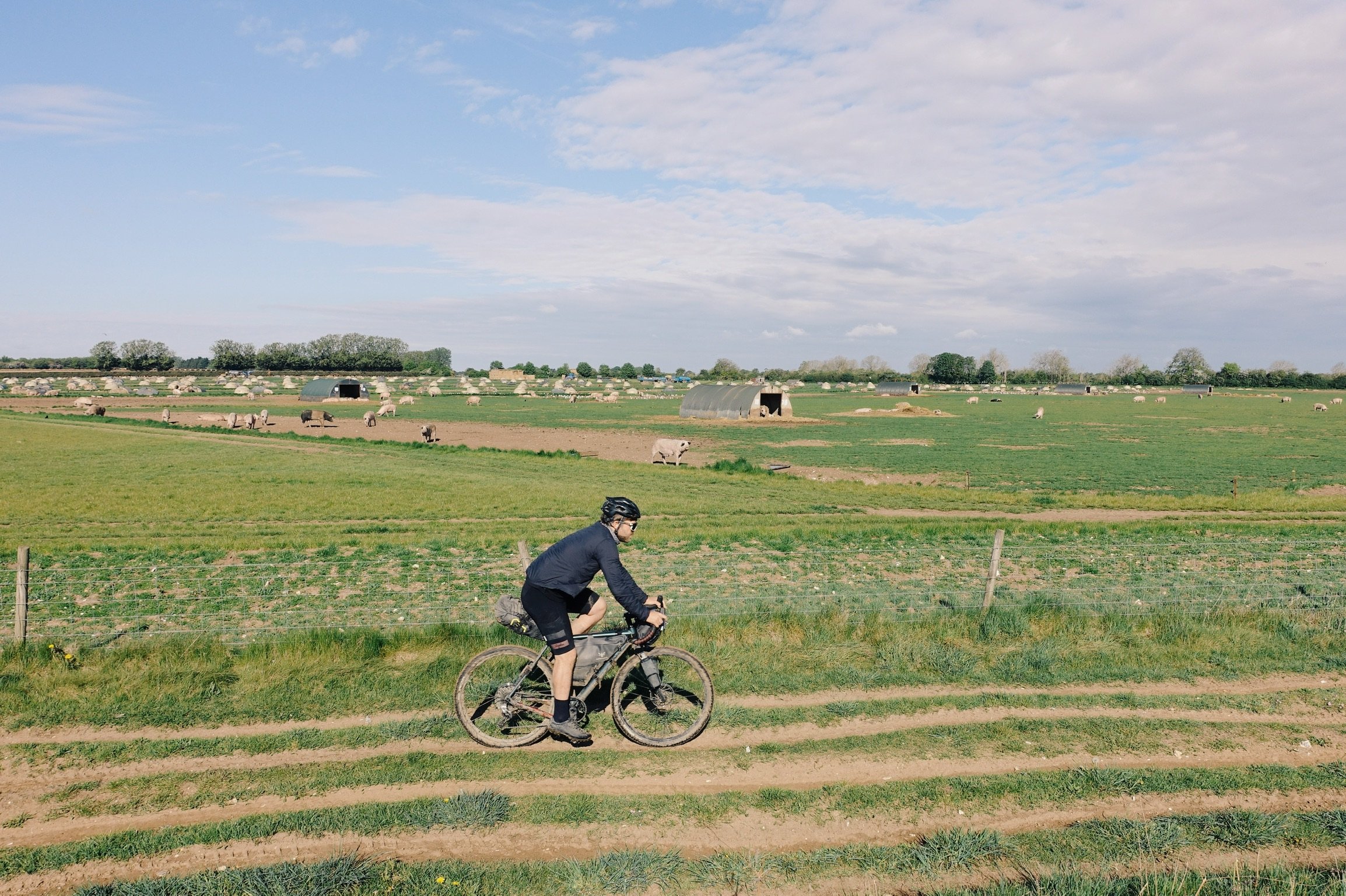
Joining the Ickneild Way, we trade the grassy chalk spine we’ve become accustomed to for sandy gravel trails lining pig farms, past huge grain stores and wide open pan flat farmland. It’s warm, but the bruised skies, charged by navy, black and purple hues threaten. The energy is cinematic. While the landscape here is fundamentally still very British, somehow it feels more like we’ve entered the American mid-west.
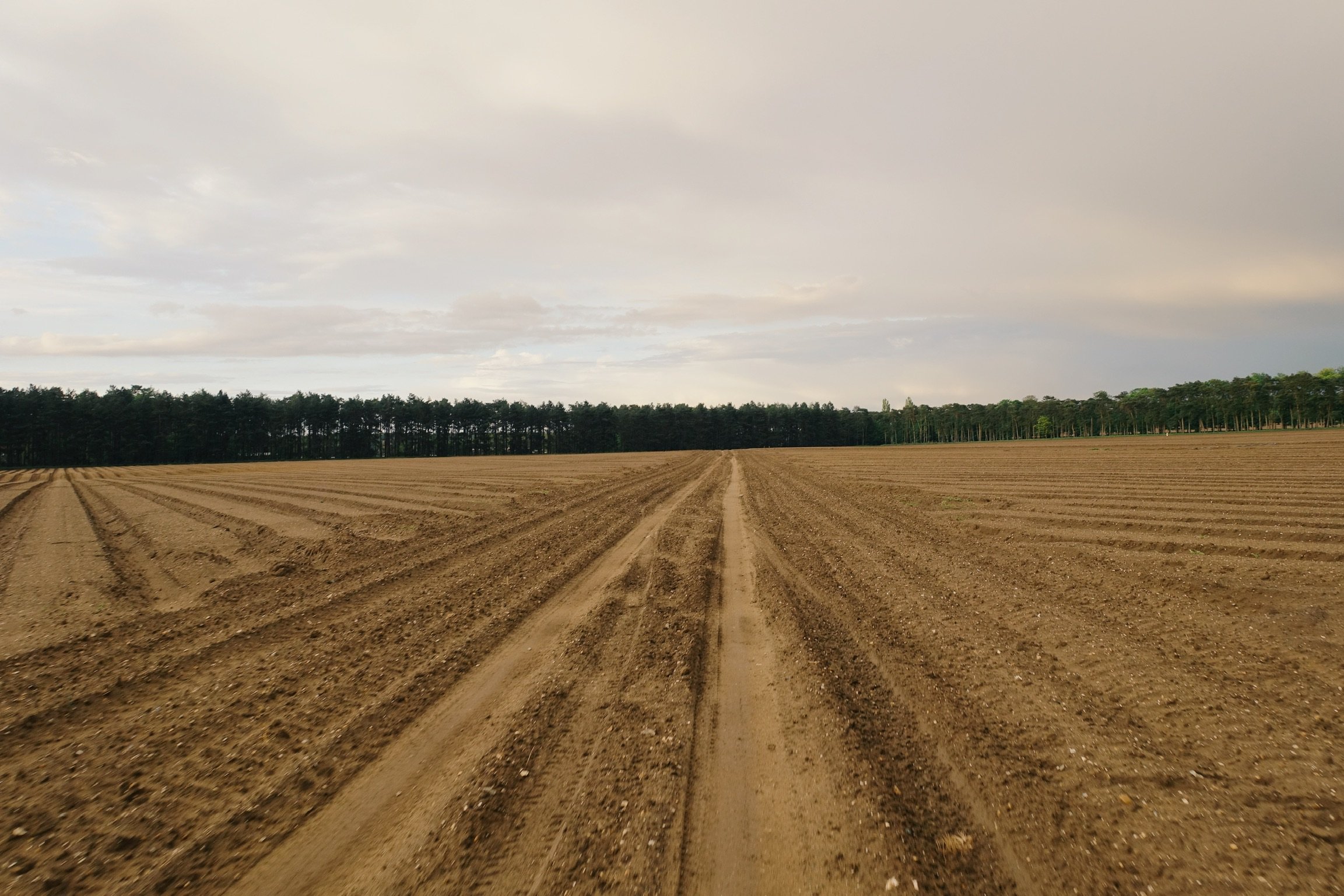

Through the heather and pines of Thetford forest, the sandy forest trails extend seemingly without end. The soft tracks make for fun riding, thanks to the intermittent down pours, our bikes feel and sound terrible, caked with wet sludge, mud, grit and sand once again. We’ve got more than 400 hilly off road kilometres in the legs, and I’m exhausted.
Eventually we reach Thetford and stuff our faces with the quantity of food only familiar of these kinds of trips. We bed down in the wedding gate of a small rural church on the outskirts of town. In the morning, we’ll join the final leg of our journey the Peddars Way, all the way to the North Sea.
Widely accepted as Roman construction, the original Peddars Way is likely to have preceded the time of the Roman conquest. The arrow straight line and latin rooted name suggesting its remodelling by the Romans rather than creation. Our direction shifts. Having ridden the past four hundred odd kilometres consistently north east, we point our bikes now north.
The energy of the final push kicks in with refreshed minds and refreshed surroundings. Our final 75km is a breeze.
Over the brow of a hill the horizon now extends way off into the distance. A faint silvery line dividing the ocean from the skies and the offshore wind farms characteristic of the North Sea. Side by side our pace quickens.
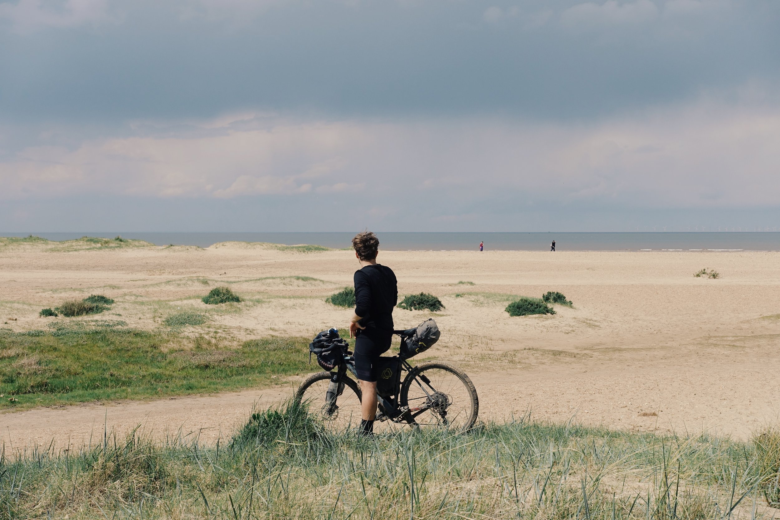
We wheel our bikes over sand dunes and through beach grass towards the shore. Coast to coast, this journey has led us more than 500 kilometres across southern England, the continuous tread of our rubber tyres following the same lines forged by foot and hoof more than 5,000 years before us. This old chalk way used by traders and drovers, druids and ramblers.
This wasn’t an epic, not a life changing adventure to the ends of the earth. Besides some routing it required minimal logistical planning. Completing the journey in five days including a weekend it didn’t require major adjustments to work and life schedules.
What those five days provided us with though was a welcome escape from day to day. A chance to empty our minds and ride the contours of our home land to connect us with the marks of history stood right before us.
For full route information for The Old Chalk Way including a downloadable GPX file, suggested bike advice and more, click here.