
The Land of Vultures: Bikerafting the Gorges du Tarn
Photos by Daniel Geiger
Rugged cliffs, deep gorges and crystal-clear water. We had the opportunity to experience the breathtaking contrasts of the region around the Gorges du Tarn on a unique bikerafting tour.
Northeast of Millau in the south of France, The Gorges du Tarn is one of the most beautiful gorges in Europe. Over a length of more than 50 kilometres, the Tarn has cut up to 500 meters into the karst plains of the Causses, as the limestone plateaus are called. The water penetrates deep into the limestone layers, literally hollowing out the rock. The originally continuous plateau was cut into blocks creating the deep gorges the region is now famous for. The deep valleys of the Lot, the Tarn, the Jonte, the Dourbie and their tributaries now form the natural boundaries of each Causse.
The contrasts between the often arid plateaus and the water-rich valleys could not be greater and the perfect opportunity experience these two completely different landscapes by gravel bikes and packraft.
On a gravel bike in the Jonte Valley
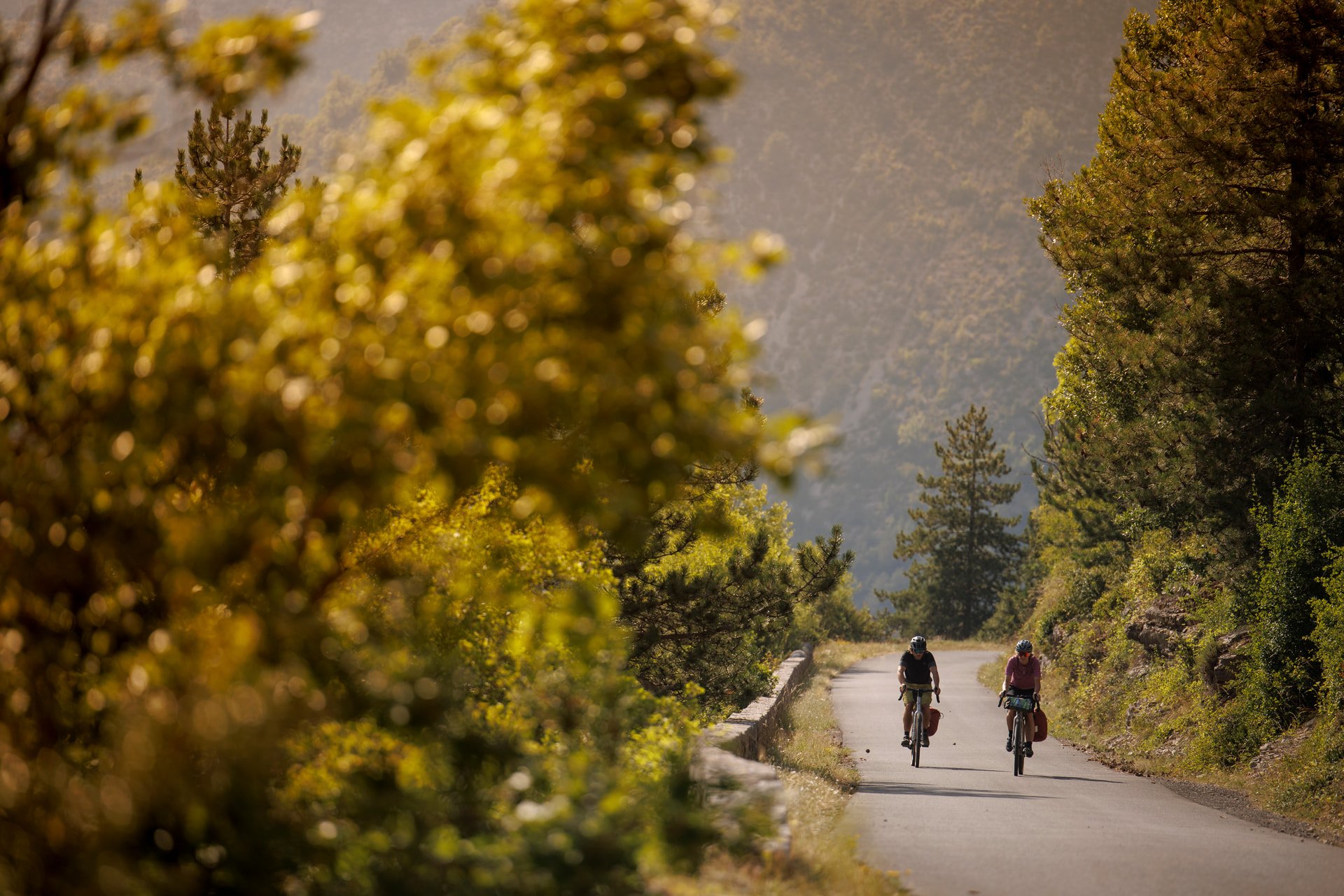
At an altitude of 400 meters, at the confluence of the Tarn and Jonte rivers, the stone houses of Le Rozier nestle against the steep slopes of the Causses Méjean. To avoid the tourist traffic, Isabella and I set off early in the morning on our loaded bikes along the main road between Le Rozier and Peyreleau into the Jonte Gorge.
We pedal uphill between vertical rock faces, accompanied by the loud chirping of crickets. High above us vultures, once extinct in the region, rule the skies once again, thanks to a successful reintroduction program in the 1980s.
Solitude on the plateau of Causses Méjean
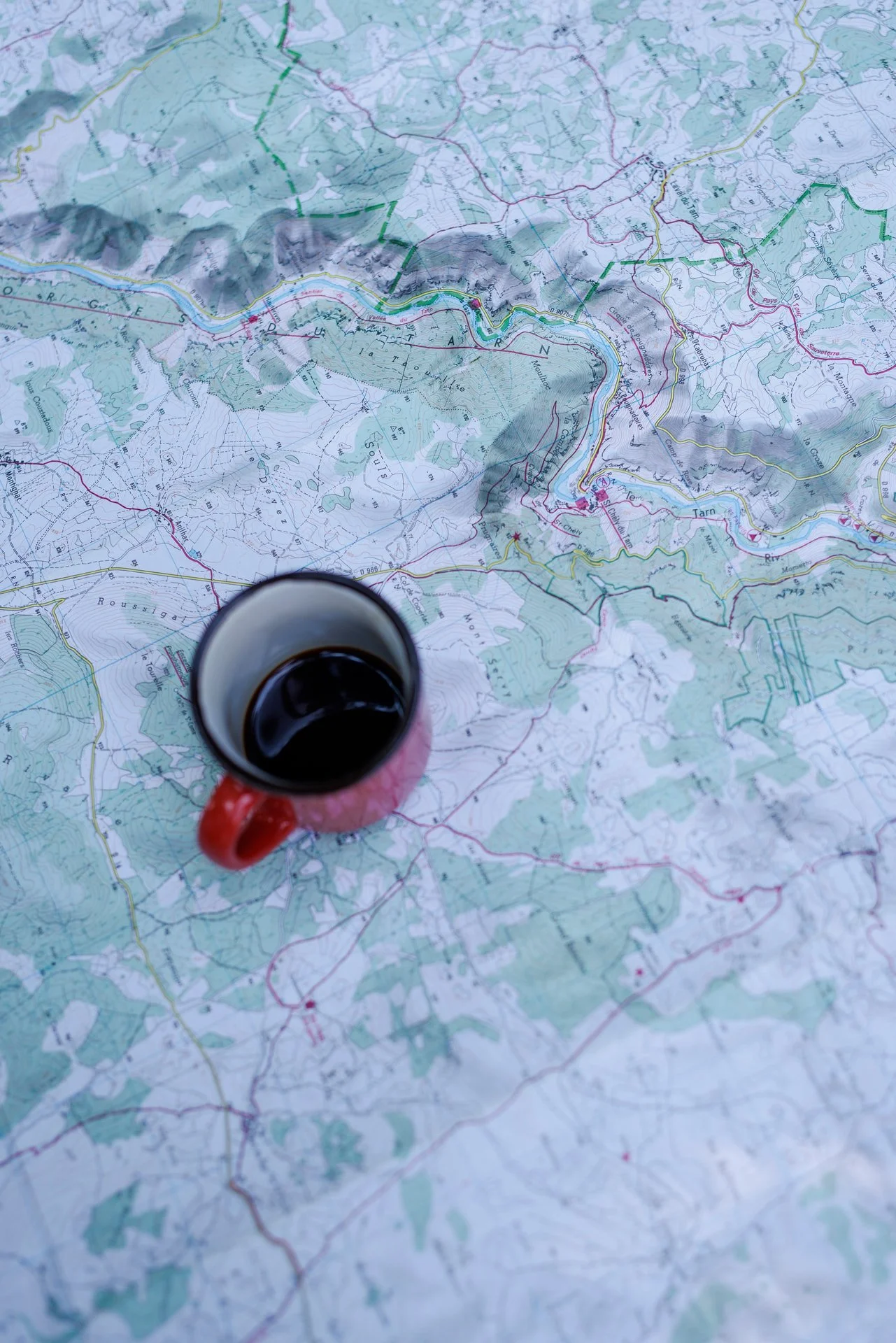
In the small hamlet of Saint-Pierre-des-Tripiers, we stopped for lunch under a few trees in the courtyard of a large Romanesque stone church. I check the GPS.
At over 900 metres, we’ve done most of the climbing for today. I share my enthusiasm while chewing. Which is just as well as the heat continues to rise during our break.
With one person per square kilometre, the Causse Méjean is sparsely populated. Here, on the highest plateau in the region, living conditions are difficult – a mountain climate with harsh winters and porous soils that exacerbate summer droughts. Accordingly, one is often alone here.
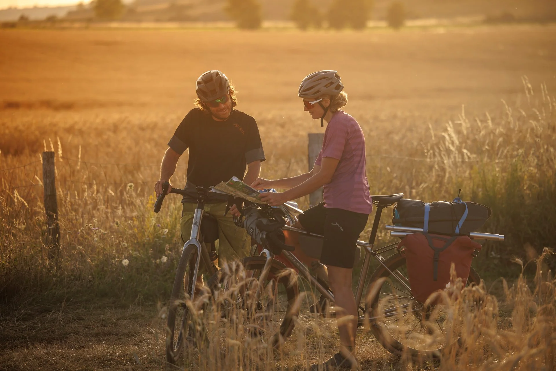
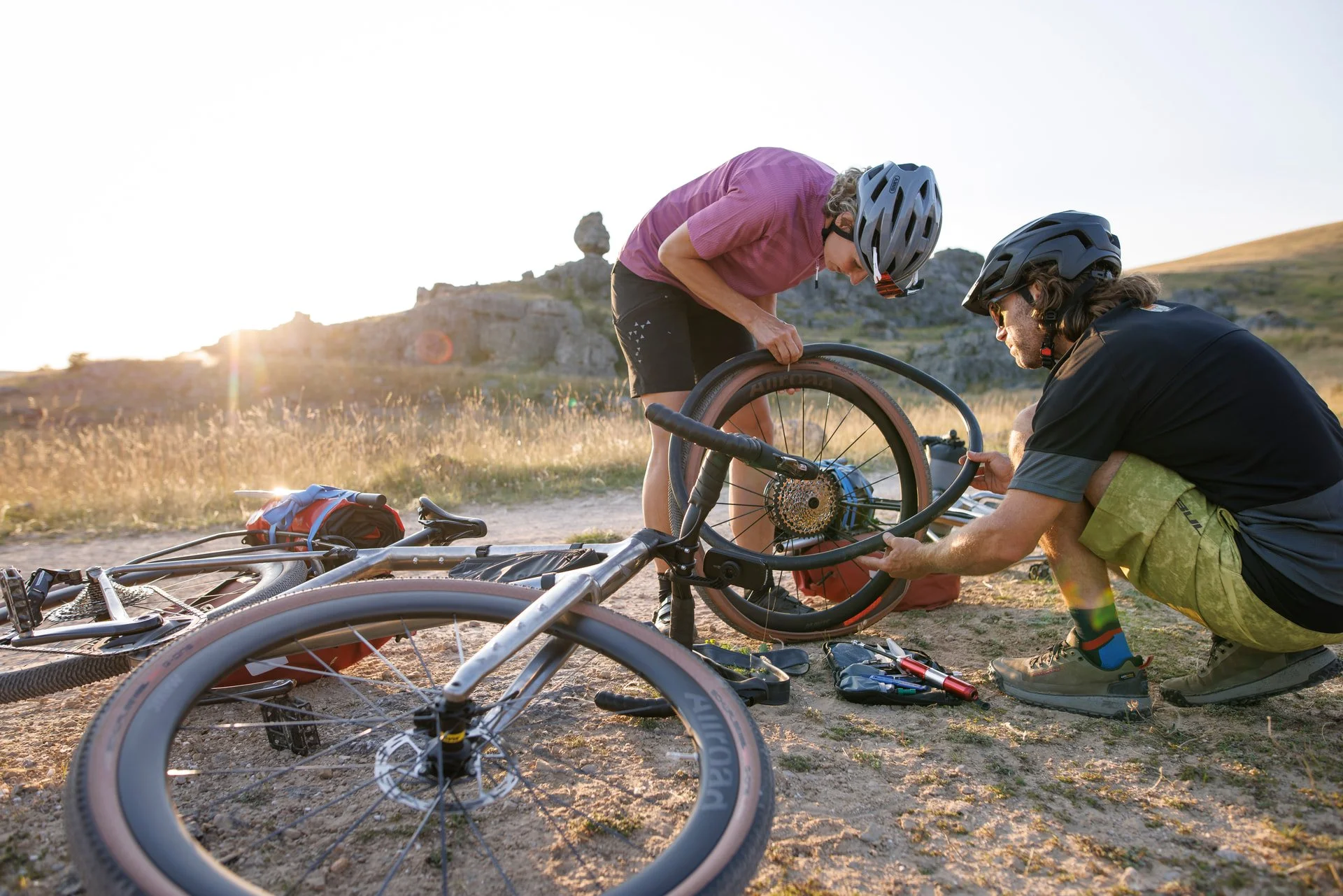
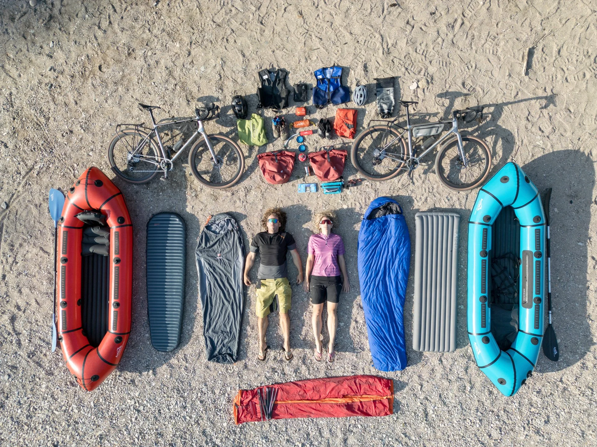
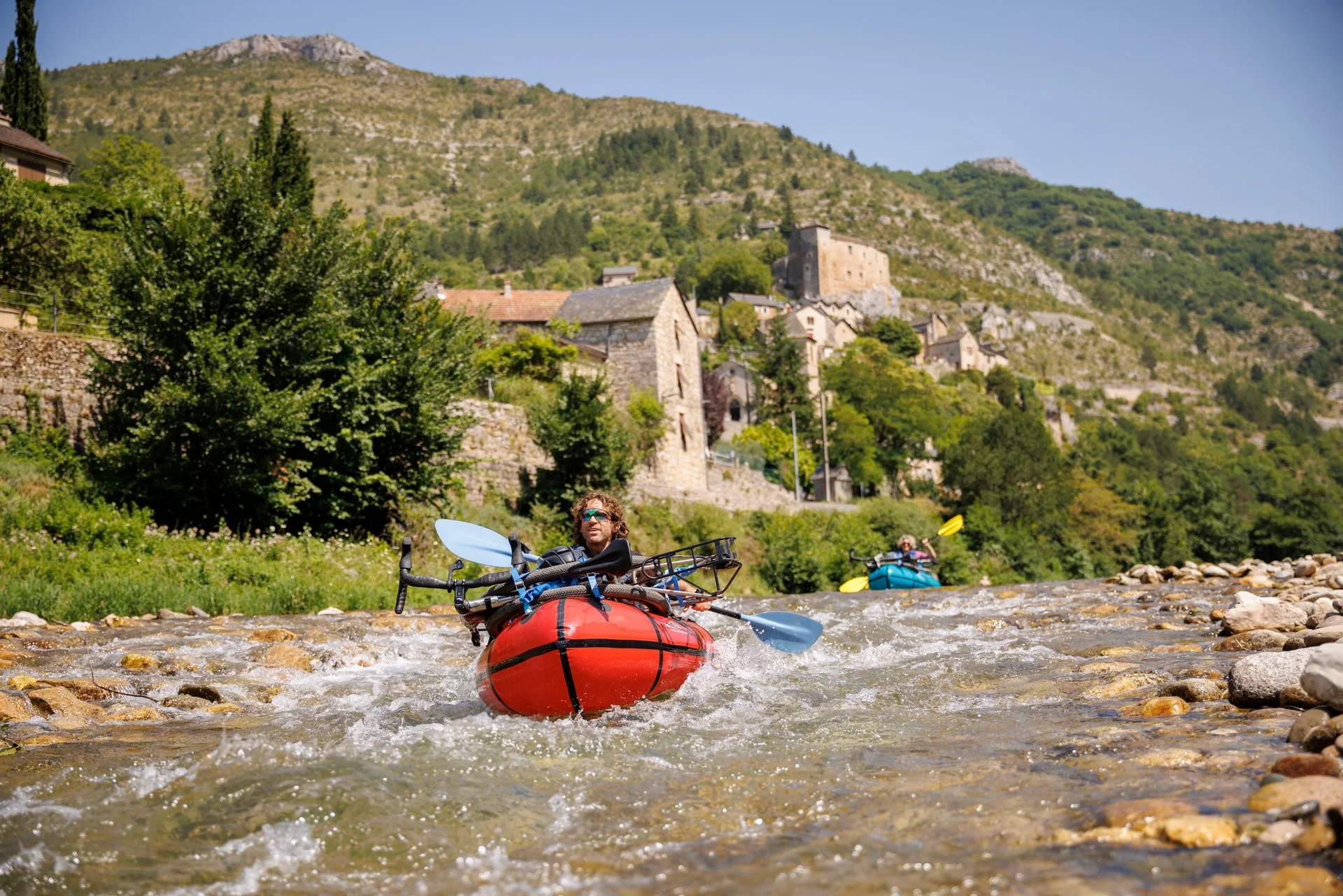
The plateau, up to 1250 metres high, is crisscrossed with small roads and paths. Before we start pedalling again, we check our luggage, the boat and paddles are securely strapped to the rack. The camping and whitewater gear is stowed in various panniers. I’m always amazed that everything we need on the bikes and on the water fits on the bike. A quick glance, a nod – the straps are tight. We set off for Le Veygalier.
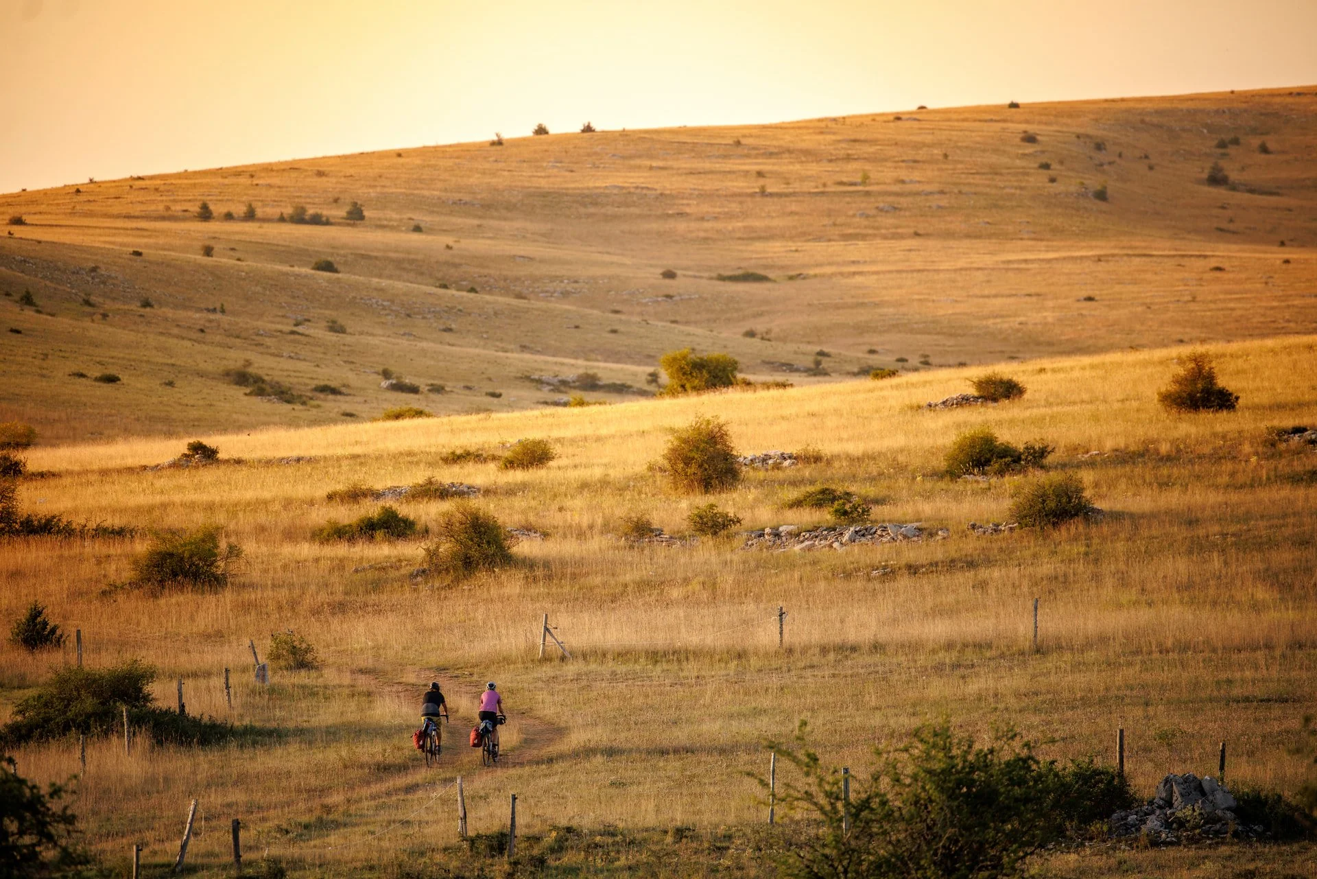
The landscape here is dominated by cornfields. Poppies decorate the golden yellow ears of corn that sway in the sun with red spots. The view stretches far across the rolling hills. Our route takes us past Aven Armand cave, a vast underground chamber contains a forest of more than 400 stalagmites, including the tallest known stalagmite in the world today at 30 metres in length!
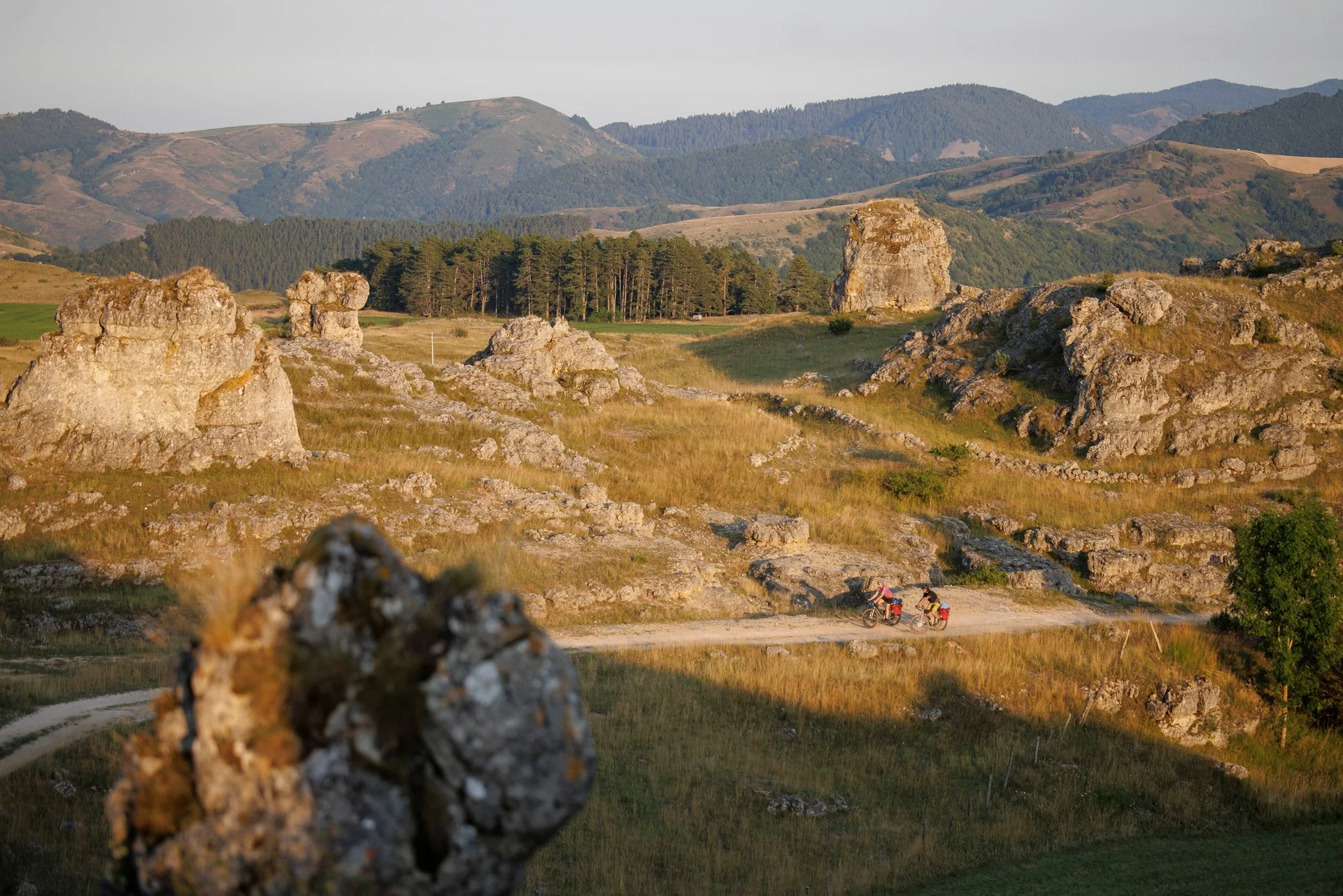
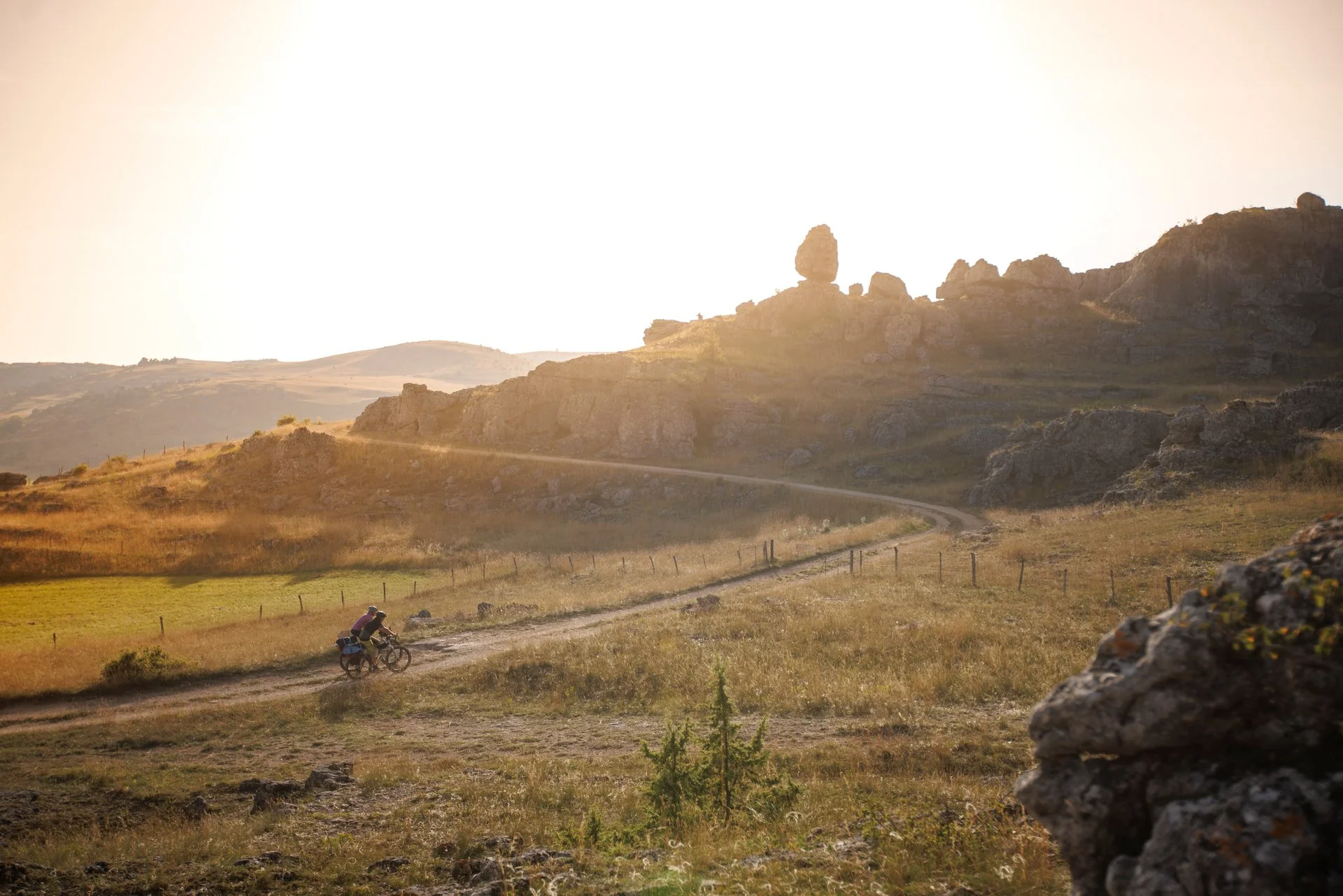
The rocky chaos in the evening light
We continue east past stone houses perfectly slotted into the landscape around us. The highlands were deforested early on, meaning no wood here is used as building material. Instead limestone is the dominant raw material. Roofs weighing several tons are covered with stone slabs. As the sun slowly moves behind us toward the horizon, wildly torn rock formations stretch into the sky in front of us. We stop for a moment. I pull out my phone to take a picture.
The rocks look like dinosaurs, casting bizarre long shadows. In the evening light, the rocky tangle of Chaos de Nîmes-le-Vieux; looks like something from another world.
The hamlet of Le Veygalier is close by where sheep have been bred for five generations. We sit down in the garden of the small inn. Homemade products such as sheep’s cheese and chestnut pâté are on the menu, along with various meat products from their slaughter. Homemade lemonade or local wines complete the experience. There is another special treat for us: those who dine here are allowed to camp on the property free of charge. We gladly accept the offer and set up camp next to bleating sheep.
Leaving for the banks of the Tarn
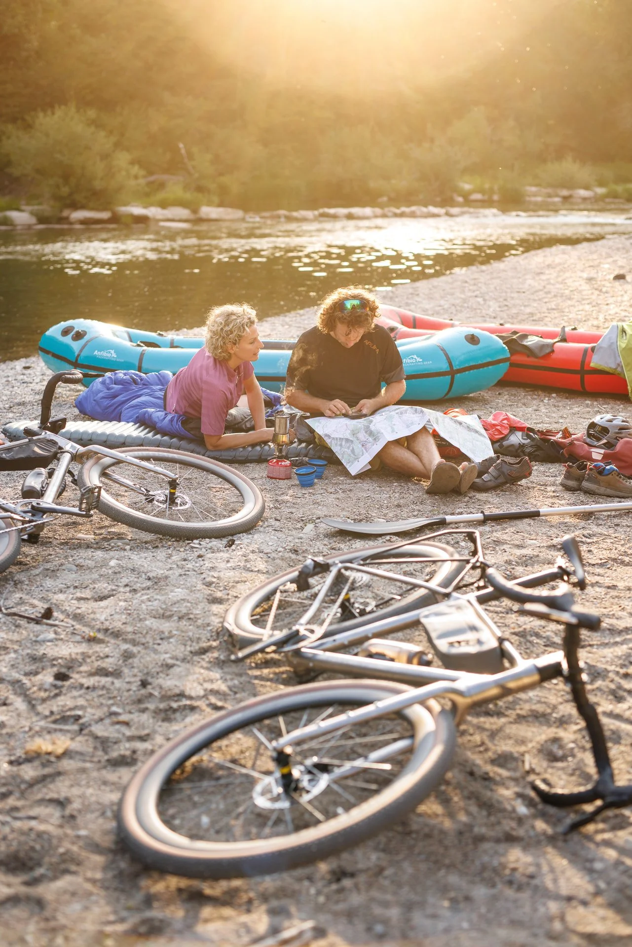
I wake, motivated by the thought of the descent into the canyon. I pack my things and look at Isabella. She is also busy with the last details. Isabella has never packrafted with bikes before. I know the setup from other trips, but I’m still a little nervous because I don’t know the Tarn either. Every river is different.
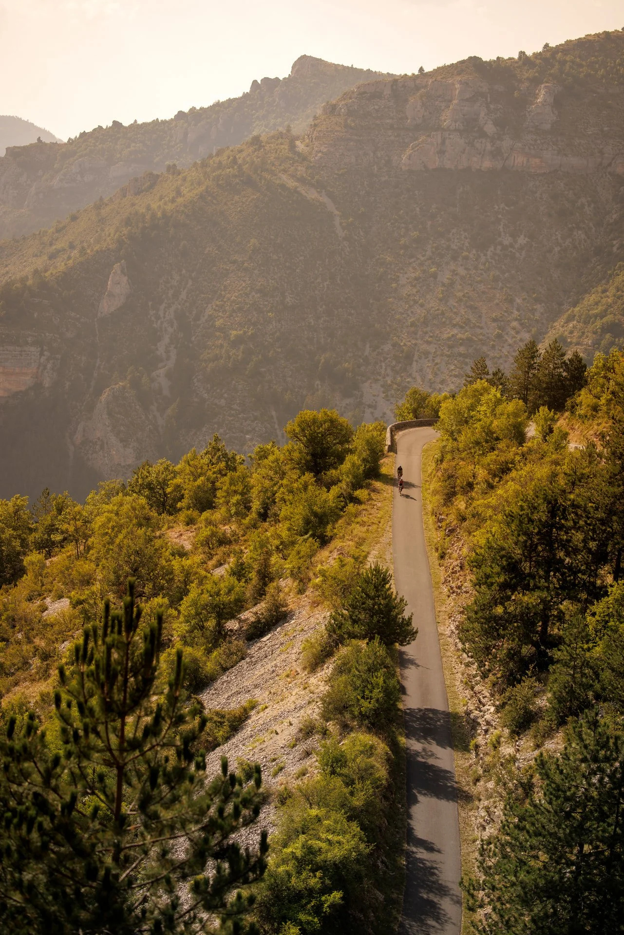
We go back a short distance on the road we came from yesterday, turning north to the edge of the Causses Méjean. Birds chirp in the cool morning air. A sign at a crossroads points to Montbrun. The medieval village is 500 yards down the left bank.
‘Look at that!’ Isabella stops. At the edge of the canyon, the view opens into the depths of the limestone gorge. ‘What a view!’ The narrow road winds deeper and deeper into the canyon. Far below us we can see the crystal clear waters of the Tarn. We wind through the narrow streets of Montbrun and follow the road downstream. At the Les Osiers campsite we will make ourselves comfortable and prepare for the rest of the day’s paddling.
But first, we swim. After the dry kilometres on the plateau, the water seems to attract us like a magnet.
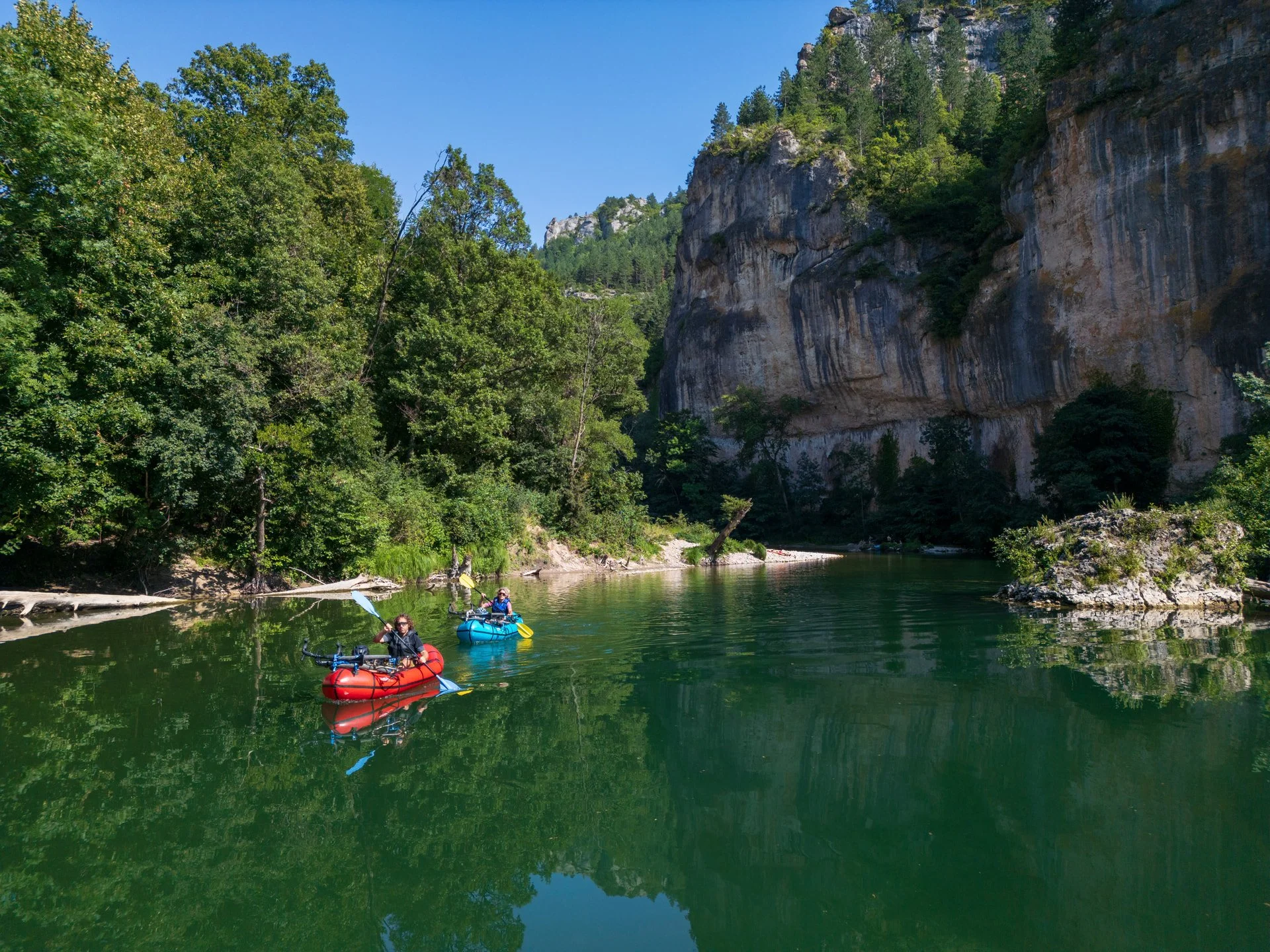
With the packrafts on the Tarn
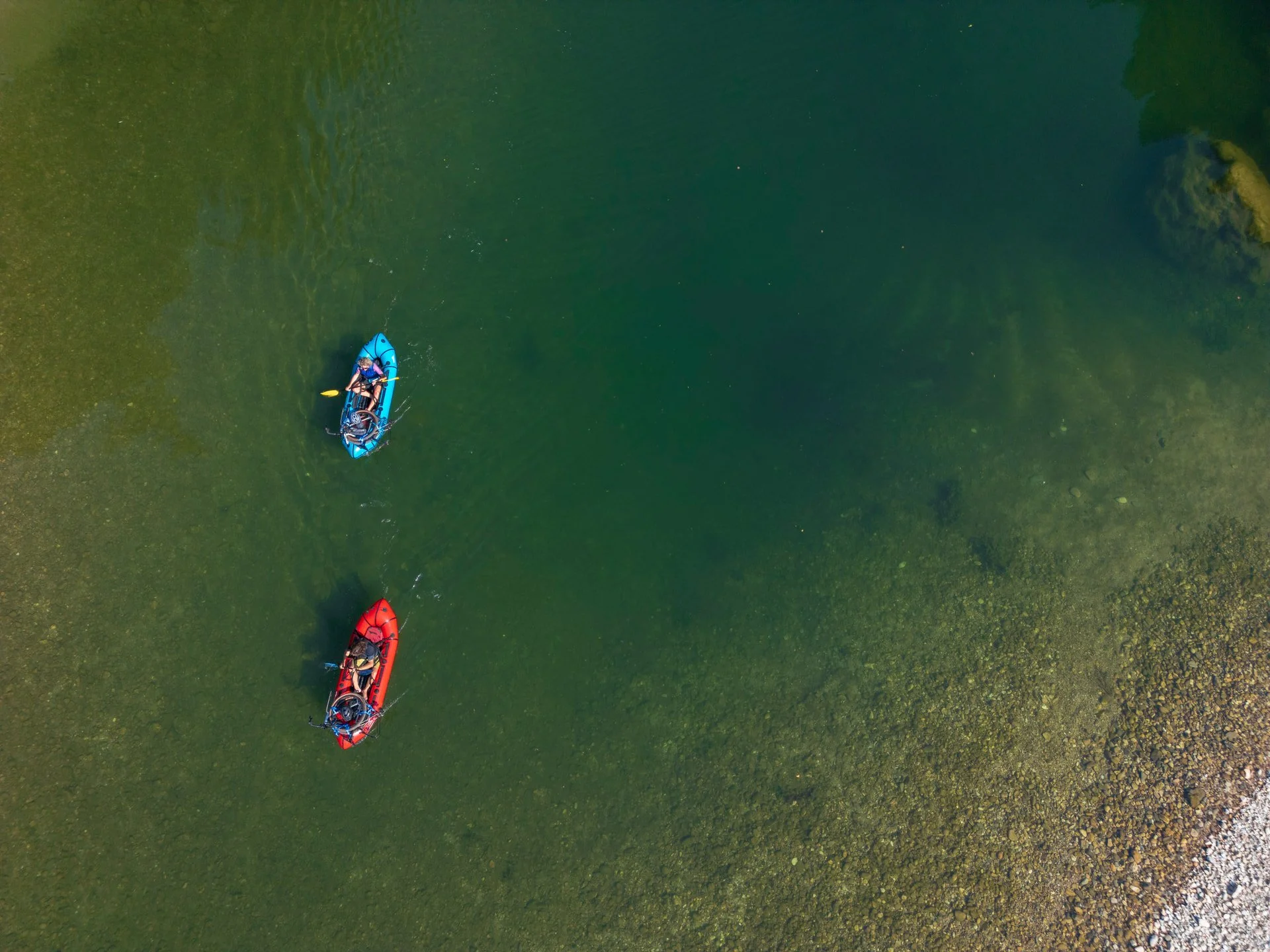
We load the bikes onto the packrafts, strap them down and double check the load. The coffee is packed and the waterproof bags are stowed in the boat. We’re ready to go.
There is no specific plan for the day. We want to paddle as long as we feel. There are campgrounds at regular intervals along the Tarn, so we can plan the stages flexibly. We hope to make the 40 kilometres to Le Rozier in two days.
The boats glide quietly through the water, the current helping us along. Now in the morning we are almost alone on the river. There are only a few swimmers enjoying the early morning hours. We soon reach the rocky basin of Castelbouc, which translates as Castle of the Goat, with its picturesque castle ruins perched on an exposed rock, surrounded by dense forest.
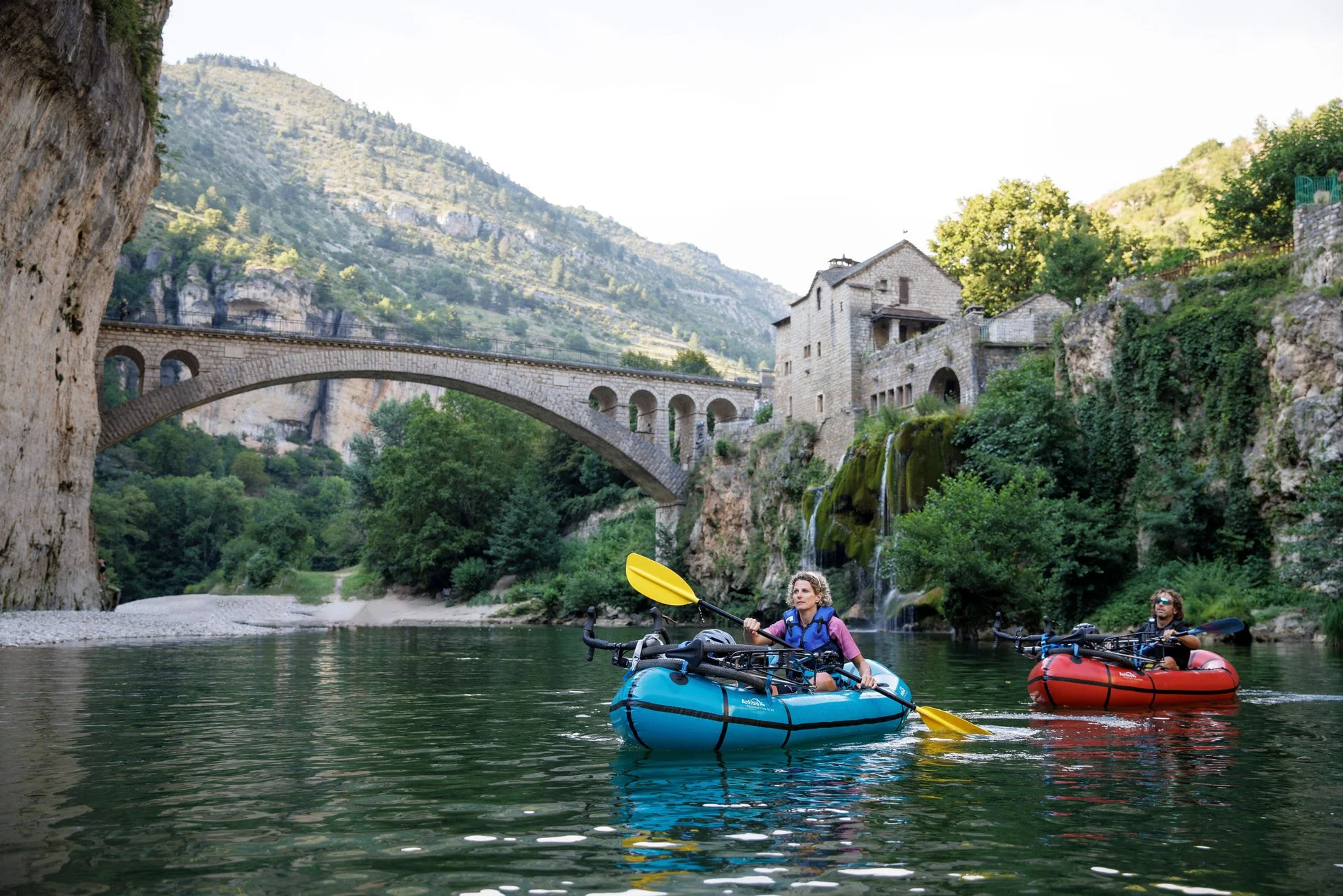
As we paddle towards the great arched bridge of Sainte-Enimie, we trade the calm waters for gentle rapids. We moor on the gravel jetty just below the bridge. A short walk through the picturesque cobblestone streets of the promenade, which we will end with a café au lait, allows us to admire a monastery built into the rock. It was founded by the Merovingian princess Enimie. She came here to cure herself of a terrible illness. Today it is empty and can be visited during the summer months. In the late afternoon, an idyllic campsite invites us to spend the night, with a view of the river, of course.
We sit around the crackling campfire, in the comfort of our insulated layers, the creek splashing gently in the background. The perfect end to a great day..
The non-navigable part of the river
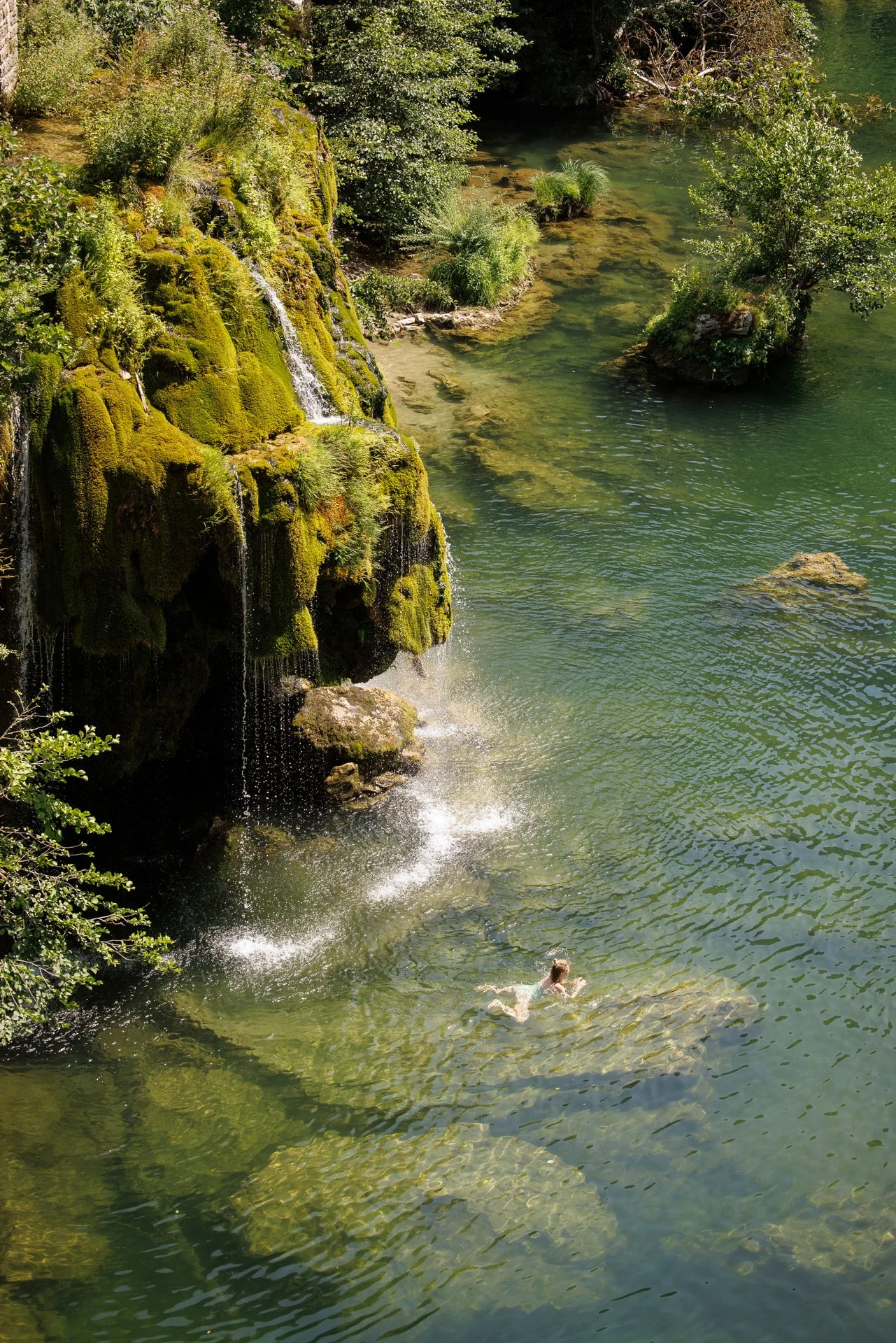
A steep, slightly overhanging rock face announces the village of Saint-Chély after the first few kilometres the next day and a large arched bridge spans the river. The houses on the left bank are built directly on the steep rock walls. From their windows you could jump into the water. Between them, a waterfall plunges over mossy green cascades. The scenery looks like something out of a fairy tale. The following section is the most unusual part of the middle Tarn. Vertical cliffs rise from the water. We drift through the magnificent canyon, it’s overhanging cliffs casting shadow over us.
An impassable point on the Tarn due to a rockfall, is marked by a sign on the right bank. A portage is unavoidable and so we carry the boats a short distance downstream along the road.
We re-enter the water into the most interesting section of the tour. Unlike the sections behind us, there are boulders strewn across the water, but accustomed to our boats and their handling over the many miles already covered, we enjoy the lush green of the moss covered rocks, the crystal clear water and the challenges of the small rapids.
The striking arch of an old stone bridge, now spanning only half of the river, marks the end of our tour. We disembark just 100 metres away on a gravel bank, stretch our legs, clap and hug. I look into Isabella’s bright eyes. ‘We were here a few days ago,’ she grins.